Section 1: Lands End & Gwendoline Hills
Sarah Point Hut
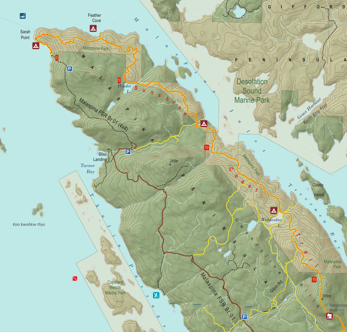
Kilometre 0
Sleeps 8
5 Facilities
About This Hut
Sarah Point Hut is the newest shelter on the Sunshine Coast Trail, built in 2021. Perched on an open rocky area at the northern trailhead, this fully enclosed hut offers panoramic views of the Salish Sea, Cortes Island, Twin Islands, and Hernando Island. The west-facing front porch provides spectacular sunset views, making it an ideal destination for starting or finishing your SCT adventure.
Key Features
- •Panoramic ocean views from front porch
- •West-facing for stunning sunsets
- •4 designated tent pads
- •Less crowded than other huts
- •Accessible by Zodiac boat pickup
How to Get There
- 1Drive from Powell River toward Sarah Point
- 2Continue approximately 2.3 km past Lund
- 3Park at the northern trailhead
- 4Hike south on the Sunshine Coast Trail
- 5Sarah Point Hut is located at the trailhead (0 km)
Trail Map
Click the map image below to download the complete section map PDF with detailed trail routes, elevation profiles, and landmarks.
Download Full Map
Explore Other Huts
Quick Info
Location
Kilometre 0
Capacity
8 people
Trail Section
Section 1
Lands End & Gwendoline Hills
Facilities
- Outhouse
- Picnic table
- Food cache
- Fire pit
- Covered porch
Water Source
Small seasonal stream (may dry up in summer)