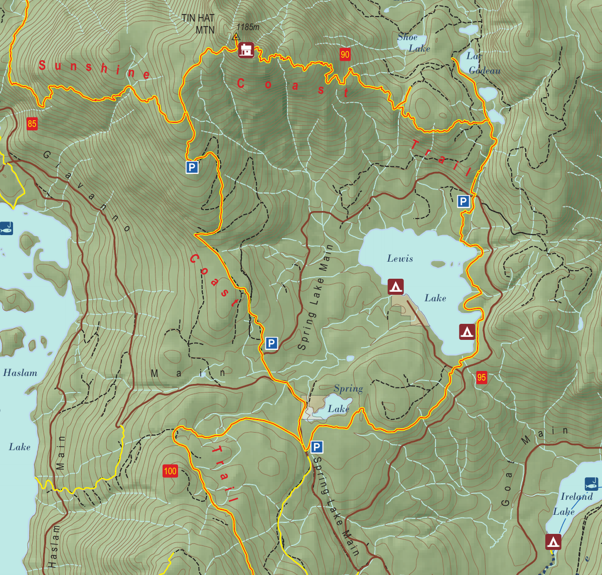
Section 8: Tinhat & Lewis Lake
Tin Hat Mountain Hut
Kilometre 90
Sleeps 8
5 Facilities
About This Hut
Tin Hat Mountain Hut is the crown jewel of the Sunshine Coast Trail, sitting at 1,193 meters elevation at the halfway point of the trail. This fully enclosed winterised hut offers incredible 360-degree panoramic views of surrounding mountains and lakes. On clear days, the vistas are truly breathtaking, making this one of the most popular destinations for both overnight hikers and thru-hikers. The summit location provides the quintessential Sunshine Coast Trail experience.
Key Features
- •360-degree panoramic mountain and lake views
- •Most scenic hut on the Sunshine Coast Trail
- •Halfway point of the trail (90 km)
- •1,193m elevation summit location
- •Winterised with pellet stove
- •Very popular - arrive early to secure space
- •Trail may have snow until mid-May
How to Get There
- 1From Fiddlehead Landing, return to main SCT and continue south
- 2Hike approximately 9 km through forested sections
- 3Begin steep climb to Tin Hat Mountain summit
- 4Follow trail markers to the 1,193m peak
- 5Hut is located at the 90 km mark on the summit
- 6Important: Collect water before arriving (no source at hut)
Trail Map
Click the map image below to download the complete section map PDF with detailed trail routes, elevation profiles, and landmarks.
Download Full Map
Quick Info
Location
Kilometre 90
Capacity
8 people
Trail Section
Section 8
Tinhat & Lewis Lake
Facilities
- Pellet stove
- Two outhouses
- Picnic tables
- Fire pit
- Two food caches
Water Source
None at hut. Collect at stream (83 km or 87 km southbound) or Lewis Lake (northbound)