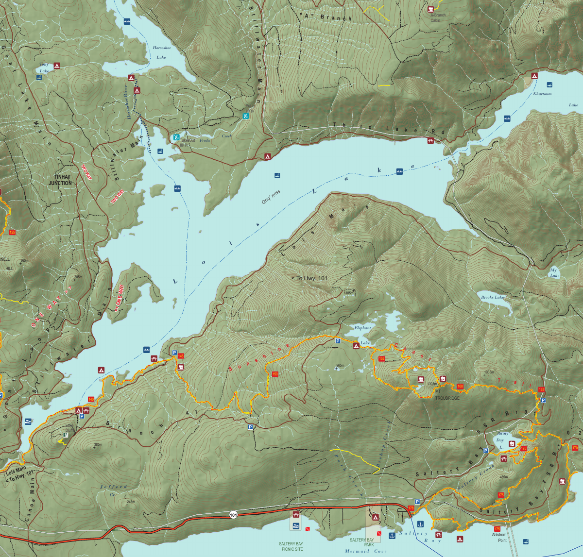
Section 11: Troubridge, Rainy Day Lake, Saltery Bay & Fairview Bay
Fairview Bay Hut
Kilometre 173
Sleeps 8
6 Facilities
About This Hut
Fairview Bay Hut holds special significance as the first hut built on the Sunshine Coast Trail in fall 2009, serving as the prototype for all subsequent shelters. This fully enclosed hut features a covered porch and sits near the southern terminus of the trail. The hut offers ocean access via a log wharf and is located close to Saltery Bay, making it an ideal final night destination for southbound hikers or a great starting point for northbound adventurers.
Key Features
- •First hut built on SCT (fall 2009)
- •Prototype design for all other shelters
- •Near southern terminus at Saltery Bay
- •Ocean access via log wharf
- •Covered porch for weather protection
- •Ideal final/first night destination
How to Get There
- 1From Rainy Day Lake Hut, continue south on the SCT
- 2Hike approximately 4 km toward Saltery Bay
- 3Descend through forested sections
- 4Follow trail markers to Fairview Bay area
- 5Hut is located at the 173 km mark
- 6Water source: signed creek 500m north of hut
- 7Southern terminus at Saltery Bay is 7 km beyond hut
Trail Map
Click the map image below to download the complete section map PDF with detailed trail routes, elevation profiles, and landmarks.
Download Full Map
Explore Other Huts
Quick Info
Location
Kilometre 173
Capacity
8 people
Trail Section
Section 11
Troubridge, Rainy Day Lake, Saltery Bay & Fairview Bay
Facilities
- Outhouse
- Picnic table
- Bear cache
- Fire pit
- Log wharf
- Covered porch
Water Source
Signed creek 500m north of hut