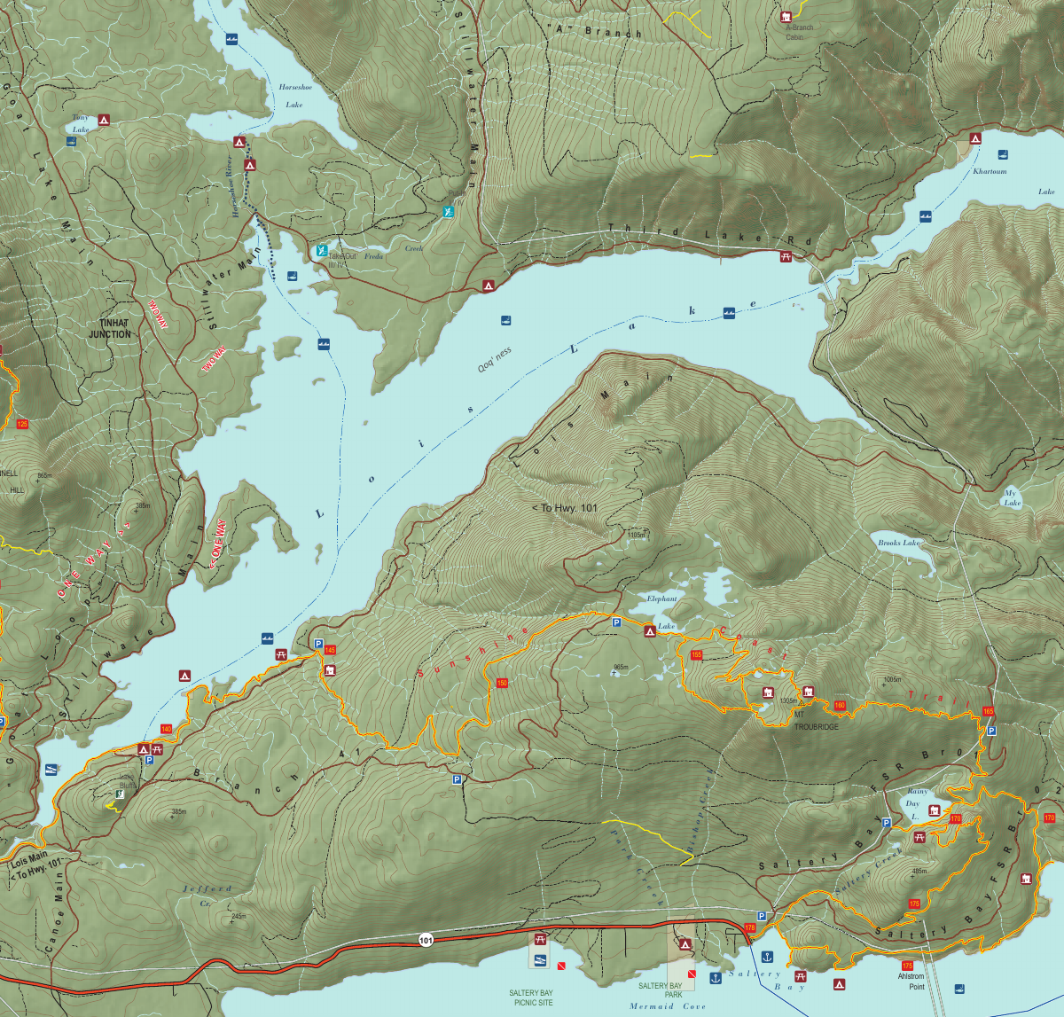
Section 11: Troubridge, Rainy Day Lake, Saltery Bay & Fairview Bay
Rainy Day Lake Hut
Kilometre 169
Sleeps 8
6 Facilities
About This Hut
Rainy Day Lake Hut perches dramatically atop Hailstone Bluff, overlooking the beautiful lake it's named after. This semi-enclosed shelter offers stunning lake views and features two picnic areas and swimming docks for enjoying the water. The hut is accessible via a 15-minute walk from a 4×4 road, making it more accessible than many other SCT huts. The elevated bluff location provides excellent vistas and a sense of openness.
Key Features
- •Perched atop Hailstone Bluff with lake views
- •Two picnic areas for relaxation
- •Swimming docks for lake access
- •15-minute walk from 4×4 road access
- •Log wharf for water activities
- •Elevated bluff location with open views
How to Get There
- 1From Mount Troubridge Hut, continue south on the SCT
- 2Hike approximately 11 km
- 3Pass Mount Troubridge Emergency Shelter at 159 km
- 4Descend from high elevation toward Rainy Day Lake
- 5Climb to Hailstone Bluff
- 6Hut is located at the 169 km mark atop the bluff
- 7Alternative: 4×4 road access with 15-min walk to hut
Trail Map
Click the map image below to download the complete section map PDF with detailed trail routes, elevation profiles, and landmarks.
Download Full Map
Quick Info
Location
Kilometre 169
Capacity
8 people
Trail Section
Section 11
Troubridge, Rainy Day Lake, Saltery Bay & Fairview Bay
Facilities
- Outhouse
- Picnic table
- Bear cache
- Fire pit
- Log wharf
- Swimming docks
Water Source
Rainy Day Lake